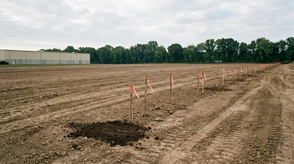
A geotechnical report is an engineer’s written record of soil borings, lab tests and groundwater readings that sets the allowable bearing pressure, expected settlement and foundation type: the 2024 IBC requires one at permit application unless waived.
Key takeaways
- The 2024 International Building Code requires a geotechnical investigation for every building unless the building official waives it on satisfactory data from adjacent sites (IBC Section 1803.2).
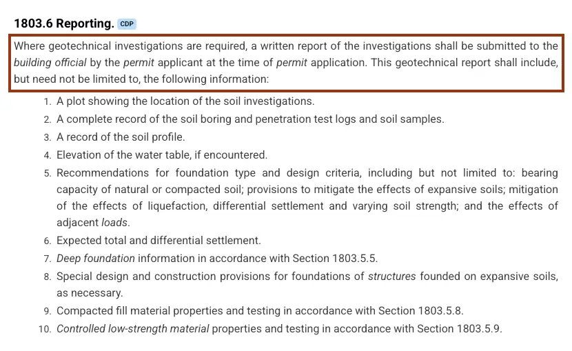
- The written report goes to the building official with the permit application and must include at least 10 items, from a boring location plan to expected total and differential settlement (IBC 1803.6).
- Without a report, footings on clay or silt are limited to 1,500 psf, and undocumented fill, peat and organic soils get no presumptive bearing value at all (IBC Table 1806.2 and Section 1806.2).
- A 21-boring investigation for a police station with a 9,000 sq ft footprint was priced at a $31,900 lump sum in December 2023, about $1,519 per boring (City of Caribou, Maine proposal).
- The same proposal scheduled drilling within 4 weeks of notice to proceed and the report 2 weeks after drilling; federal building awards on USAspending.gov ran 33 to 180 day contract windows.
- Seismic site class now has nine possible values including BC, CD and DE under ASCE 7-22 Table 20.2-1, as reproduced by the Washington Geological Survey (2026).
What does a geotechnical report contain?
A geotechnical report contains a boring location plan, the boring and penetration test logs, a soil profile, the groundwater elevation, recommended foundation type and design bearing values, and expected total and differential settlement. Those are 6 of the 10 items that 2024 IBC Section 1803.6 lists as the minimum content of a report filed with a permit application.
| IBC 1803.6 item | What you will see in the report | Why it matters to the owner |
|---|---|---|
| 1. Plot of soil investigations | Site plan with each boring or test pit numbered | Shows whether borings sit under the footprint you actually built |
| 2. Boring and penetration test logs | One log per boring: depth, soil description, SPT blow counts (N-values), samples | The raw evidence; ask for them as an appendix, not a summary |
| 3. Soil profile | Layers with depth and USCS symbol (for example CL, SM, GP) | Tells the designer which layer the footings bear on |
| 4. Water table elevation | Depth to water during and after drilling | Drives dewatering, basement waterproofing and slab vapor control |
| 5. Foundation type and design criteria | Allowable bearing pressure (psf), footing depth, expansive soil, liquefaction and fill measures | Sets footing size and whether piles or ground improvement are needed |
| 6. Expected settlement | Total and differential settlement in inches | Checks the structure against its tolerance |
| 7. Deep foundation information | Pile or pier type, capacity, spacing, load tests (per 1803.5.5) | Only when deep foundations are recommended |
| 8. Expansive soil provisions | Slab and footing design method, moisture or removal measures | Only where soils swell |
| 9. Compacted fill properties and testing | Fill specification, lift thickness, density targets (per 1803.5.8) | Becomes the earthwork spec and the special inspection basis |
| 10. CLSM properties and testing | Flowable fill strength and acceptance tests (per 1803.5.9) | Only where footings bear on flowable fill |
Most reports add items the code does not list. The December 2023 Caribou police station proposal promised excavation and dewatering advice, a seismic site class by the N-value method, a subgrade modulus for floor slabs, compaction criteria and whether site soils can be reused as fill. Ask for those lines in the proposal so they are priced, not added later.
When does the building code require a geotechnical report?
Under the 2024 IBC the default is that every building gets a geotechnical investigation. Section 1803.2 lets the building official waive it only where satisfactory data from adjacent areas shows no investigation is needed for the listed soil, groundwater, rock and seismic conditions. Several site conditions then add mandatory content, as the table and chart below show (IBC Chapter 18).
| Condition on your site | Code section | What the report must then cover |
|---|---|---|
| Any new building (default) | 1803.2 | Investigation per 1803.3 to 1803.5; report per 1803.6 |
| Soil classification, strength or compressibility in doubt, or you want a bearing value above Table 1806.2 | 1803.5.2 | Building official may require an investigation to support the higher value |
| Area likely to have expansive soil | 1803.5.3 | Soil tests: plasticity index 15 or more (ASTM D4318), over 10% passing the No. 200 sieve and over 10% finer than 5 micrometers (ASTM D6913), or expansion index above 20 (ASTM D4829) |
| Lowest floor below adjacent grade with groundwater above or within 5 ft below it | 1803.5.4 | Groundwater evaluation; waterproofing under 1805.3 if hydrostatic pressure exists |
| Deep foundations (piles, drilled piers) | 1803.5.5 | 9 items: types and capacities, spacing, driving criteria, installation, inspection, load tests, material suitability, bearing stratum, group effects |
| Foundations on or in rock | 1803.5.6 | Variation in rock depth, competency and bearing capacity |
| Shallow footings on compacted fill more than 12 in deep | 1803.5.8 | 7 items: site prep, fill material, density test method, lift thickness, field test, minimum percent of maximum dry density, test frequency |
| Seismic Design Category C, D, E or F | 1803.5.11 | Slope instability, liquefaction, total and differential settlement, surface displacement from faulting or lateral spreading |
| Seismic Design Category D, E or F | 1803.5.12 | Adds dynamic earth pressure on walls retaining more than 6 ft of backfill, liquefaction at the maximum considered earthquake, consequences and mitigation |
Can the building official waive the report?
Yes, but only on evidence. The 1803.2 exception requires satisfactory data from adjacent areas, such as a recent report for the lot next door, covering classification, questionable soil, expansive soil, groundwater, deep foundations, rock, slope setbacks (1803.5.10) and seismic hazards (1803.5.11). If you get a waiver, get it in writing with the permit record, because Table 1806.2 limits then apply to the footing design.
Fill under footings has a separate small-job exception. Under IBC 1804.6, compacted fill 12 inches deep or less may skip the approved report if it reaches at least 90% of maximum dry density by ASTM D1557, verified by special inspection under Section 1705.6. Deeper fill under shallow footings always needs the 7 report items in 1803.5.8.
How do you read the key numbers in a geotechnical report?
Five numbers do most of the work: the allowable bearing pressure in pounds per square foot (psf), SPT N-values from ASTM D1586 blow counts, depth to groundwater, expected settlement in inches, and the seismic site class. Compare the bearing value with the presumptive values in IBC Table 1806.2, which is what the designer must use if no report supports more.
| Number | Unit | What it tells you | Code anchor or benchmark |
|---|---|---|---|
| Allowable bearing pressure | psf | Load each square foot of footing may carry | Table 1806.2 presumptive: 1,500 (clay, silt) to 12,000 (crystalline bedrock) |
| SPT N-value | blows per foot | Density or stiffness of each layer from the split-spoon test; low counts flag soft or loose soil | ASTM D1586; sampled at 2 to 5 ft intervals in the Caribou and Capron proposals |
| Groundwater depth | ft below grade | Whether a basement or deep footing needs dewatering or waterproofing | 1803.5.4: within 5 ft of a below-grade floor triggers evaluation |
| Total and differential settlement | in | How much footings sink, and how unevenly | Portage County, Wisconsin (2025) design target: 1 in total, 1/2 in differential |
| Plasticity index (PI) and expansion index (EI) | none | Swell risk under slabs and footings | Expansive if PI 15 or more with fines tests, or EI above 20 (1803.5.3) |
| Minimum footing depth | in | Frost depth or weak upper soil | Code floor: 12 in deep and 12 in wide (1809.4) |
| Seismic site class | letter | Amplification of earthquake shaking | A to E plus F under ASCE 7-22; DE, E or F changes how the Seismic Design Category is set (IBC 1613.2) |
Table 1806.2 values also cover sideways loads. Lateral bearing runs from 100 psf per foot of depth in clay to 1,200 in crystalline bedrock, and the sliding friction coefficient from 0.25 in sands to 0.70 on bedrock, with 130 psf cohesion for clays. A report may justify higher values, which matters for metal buildings whose anchor rods carry outward thrust and uplift, as our pre-engineered metal building guide explains.
| Table 1806.2 class of material | Vertical pressure (psf) | Lateral bearing (psf/ft) | Friction coefficient | Cohesion (psf) |
|---|---|---|---|---|
| 1. Crystalline bedrock | 12,000 | 1,200 | 0.70 | none |
| 2. Sedimentary and foliated rock | 4,000 | 400 | 0.35 | none |
| 3. Sandy gravel and gravel (GW, GP) | 3,000 | 200 | 0.35 | none |
| 4. Sand, silty sand, clayey sand, silty gravel, clayey gravel (SW, SP, SM, SC, GM, GC) | 2,000 | 150 | 0.25 | none |
| 5. Clay, sandy clay, silty clay, clayey silt, silt, sandy silt (CL, ML, MH, CH) | 1,500 | 100 | none | 130 |
| Mud, organic silt and clay (OL, OH), peat (Pt), undocumented fill | No presumptive value without data |
What does seismic site class mean in a 2024 report?
Site class grades how much the top 100 ft of ground amplifies shaking, measured by average shear wave velocity. The 2024 IBC points to ASCE 7-22, whose Table 20.2-1 has nine classes, adding BC, CD and DE to the older A to F set. Under IBC 1613.2, Site Class DE, E or F means the Seismic Design Category must come from ASCE 7 rather than the IBC maps.
| Site class | Material | Average shear wave velocity (ft/s) |
|---|---|---|
| A | Hard rock | More than 5,000 |
| B | Medium hard rock | 3,000 to 5,000 |
| BC | Soft rock | 2,100 to 3,000 |
| C | Very dense sand, hard clay | 1,450 to 2,100 |
| CD | Dense sand, very stiff clay | 1,000 to 1,450 |
| D | Medium dense sand, stiff clay | 700 to 1,000 |
| DE | Loose sand, medium stiff clay | 500 to 700 |
| E | Very loose sand, soft clay | Less than 500 |
| F | Soils needing site-specific evaluation (for example liquefiable) | Not set by velocity |
Velocity can be measured instead of estimated from blow counts. A November 2023 Army order paid $4,618 for a refraction microtremor (ReMi) shear wave survey to support the design of a five-story barracks at Fort Leonard Wood, Missouri (USAspending). Check which method your report used: the 2023 Caribou proposal still named the IBC 2015 N-value method.
What does the report say about the floor slab?
For slabs, look for three lines: the subgrade modulus (often written k, in pounds per cubic inch) the slab designer uses, the fill and compaction spec under the slab, and any expansive soil method. The code floor is a 3 1/2 inch slab over a 6-mil polyethylene vapor retarder lapped at least 6 inches (IBC 1907.3 and 1907.4). On expansive soil, slabs follow WRI/CRSI or PTI DC 10.5 under IBC 1808.6.2.
Slab advice matters most on buildings cast on their own floor. Tilt-up wall panels are poured on the floor slab and lifted from it (ACI 551.1R-14), so slab support carries into the wall schedule, as our tilt-up construction guide sets out.
How much does a geotechnical report cost for a commercial building?
Public records for commercial and institutional sites run from $4,800 for a 10-boring pavement study to $31,900 for a 21-boring police station investigation, and $6,826 to $78,137 for federal building orders on USAspending.gov. Price follows boring count and depth: the Caribou proposal priced extra borings at $20 per foot in soil and $50 per foot in rock.
| Project and owner | Borings stated | Price | Date | Source |
|---|---|---|---|---|
| Police station, about 9,000 sq ft footprint, 2 stories with walk-out basement, City of Caribou, Maine | 21: 4 in footprint and 9 at perimeter to 30 ft; 8 site borings to 10 ft; rock core if refusal | $31,900 lump sum | Dec 2023 | City proposal file |
| Public safety facility feasibility study, Town of Boxborough, Massachusetts | 2 to 25 ft or bedrock refusal, up to 5 ft rock core each | $8,950 lump sum | Dec 2020 | Town document |
| Elementary school parking lots, Capron, Illinois | 10 to 7.5 ft | $4,800 lump sum (+$1,000 utility locator option) | Dec 2020 | North Boone CUSD 200 file |
| Mobility warehouse geotechnical report, NAS JRB Fort Worth, Texas | Not stated | $6,826 | Aug 2025 | USAspending |
| Geotechnical survey, 815 South Garden Street, Columbia, Tennessee (GSA) | Not stated | $8,126 | Jul 2023 | USAspending |
| Nature center, Zion National Park, Utah | Not stated | $10,221 | Dec 2024 | USAspending |
| Child development center, Scott AFB, Illinois | Not stated | $59,884 | May 2022 | USAspending |
| Guided missile assembly building, White Sands Missile Range, New Mexico (3 offers) | Not stated | $70,700 | Jan 2024 | USAspending |
| Air traffic control tower, Fort Campbell, Kentucky | Not stated | $78,137 | Jan 2024 | USAspending |
Unit prices make records comparable. Caribou works out to about $1,519 per boring, or about $67.87 per drilled foot if all 470 ft (13 borings at 30 ft plus 8 at 10 ft) are drilled; refusal on rock would shorten the footage and raise the per-foot figure. Boxborough’s feasibility study is $4,475 per boring because 2 borings carried the fixed cost of a report and rock coring.
| What moves the price | Effect in the public records | Source |
|---|---|---|
| Extra soil borings | $20 per foot drilled | Caribou proposal, Dec 2023 |
| Rock coring | $50 per foot; up to 5 ft of core per boring | Caribou proposal, Dec 2023 |
| Extra drill days | $4,900 per day | Caribou proposal, Dec 2023 |
| Private utility locating | $250 per hour, or $1,000 lump sum on the Capron job | Capron proposal, Dec 2020 |
| Engineer time beyond scope | $110 to $225 per hour by staff level | Boxborough fee schedule, Dec 2020 |
| Construction-phase services (fill testing, footing inspection) | Excluded from the Caribou lump sum; billed at unit rates | Caribou proposal, Dec 2023 |
Our commercial construction cost per square foot guide shows where survey, geotechnical and environmental studies sit in the soft-cost budget.
How long does a geotechnical report take?
Expect about 3 weeks for a small job and 6 weeks or more for a building. The 2023 Caribou proposal put drilling within 4 weeks of notice to proceed and the report within 2 weeks after drilling, and a 2020 Illinois pavement study quoted about 3 weeks in total. Because IBC 1803.6 wants the report at permit application, it sits on the critical path.
| Record | Stated schedule or contract window | Source |
|---|---|---|
| Caribou, Maine police station (21 borings) | Drilling within 4 weeks of notice to proceed; report within 2 weeks after explorations; preliminary data on request | Dec 2023 proposal |
| Capron, Illinois school pavement (10 borings) | About 3 weeks from signed acceptance to final report | Dec 2020 proposal |
| Portage County, Wisconsin law enforcement center (15 base-bid borings to 35 ft) | Bid form asks for days to start drilling and days to report after drilling | RFB 2025-11PC, June 2025 |
| Mobility warehouse report, Fort Worth, Texas | 33 days (Aug 8 to Sep 10, 2025) | USAspending |
| GSA site, Columbia, Tennessee | 47 days (Jul 14 to Aug 30, 2023) | USAspending |
| Zion National Park nature center | 76 days (Dec 20, 2024 to Mar 6, 2025) | USAspending |
| Scott AFB child development center | 180 days (May 12 to Nov 8, 2022) | USAspending |
Order the report after the site is under contract and the footprint is roughly fixed, because Section 1803.3.1 has the engineer place borings against it, but before structural design. Owners buying land often run it beside the Phase I environmental site assessment.
How can a geotechnical report change the foundation design?
The report sets the bearing pressure, and footing area is column load divided by bearing pressure. Using the 75, 225 and 375 kip column loads that Portage County, Wisconsin published for its 2025 law enforcement center, a report that supports 3,000 psf instead of the 1,500 psf clay value in Table 1806.2 halves every footing’s plan area.
| Service column load | Area at 1,500 psf (Table 1806.2 clay) | Square footing side | Area at 3,000 psf (illustrative report value) | Square footing side |
|---|---|---|---|---|
| 75 kips (single-story) | 75,000 / 1,500 = 50 sq ft | 7.07 ft | 75,000 / 3,000 = 25 sq ft | 5.00 ft |
| 225 kips (two-story) | 225,000 / 1,500 = 150 sq ft | 12.25 ft | 225,000 / 3,000 = 75 sq ft | 8.66 ft |
| 375 kips (two-story plus basement) | 375,000 / 1,500 = 250 sq ft | 15.81 ft | 375,000 / 3,000 = 125 sq ft | 11.18 ft |
At an assumed 2 ft thickness, the 225 kip footing drops from 300 cu ft (11.1 cu yd) of concrete to 150 cu ft (5.6 cu yd). This is simplified CB&C arithmetic: it ignores footing self-weight and overburden, and a settlement limit such as Portage County’s 1 in total and 1/2 in differential can govern before bearing does. The 3,000 psf figure is illustrative, not a value from any report.
The report can also push the design the other way. If borings find undocumented fill, peat or organic clay, Section 1806.2 gives no presumptive value, so the options are removal and recompaction under the 1803.5.8 fill spec or deep foundations under 1803.5.5. The decision table maps what the report finds to what the design team does.
| If the report finds | Then the design typically | Code section |
|---|---|---|
| Bearing pressure at or above the Table 1806.2 value for the soil | Uses spread footings sized from the report value, at least 12 in deep and 12 in wide | 1806.2, 1809.4 |
| Undocumented fill, peat, OL or OH soils at footing level | Over-excavates and replaces with compacted fill, or switches to piles or piers | 1806.2, 1803.5.8, 1803.5.5 |
| Plasticity index 15 or more and expansion index above 20 | Designs the slab by WRI/CRSI or PTI DC 10.5, removes the soil to stable moisture depth, or stabilizes it | 1803.5.3, 1808.6 |
| Groundwater within 5 ft below a basement floor | Adds waterproofing and drainage, or raises the floor (Portage County left its basement decision to the report) | 1803.5.4, 1805.3 |
| Site Class DE, E or F | Sets the Seismic Design Category by ASCE 7 and checks liquefaction | 1613.2, 1803.5.11 |
| Rock within footing depth | Designs for variable rock depth; budgets coring and rock excavation | 1803.5.6 |
For a metal building, the manufacturer’s anchor rod plan gives the column reactions, and the foundation engineer sizes footings from those reactions and the report so the allowable bearing pressure is not exceeded (IBC 1808.2). Our metal building kits guide lists the report among the items the kit price leaves out.
What should you send the geotechnical engineer, and what should you ask?
Send the footprint, loads and below-grade plans before the engineer sets the boring plan, because IBC 1803.3.1 makes the registered design professional responsible for the number and depth of borings. Portage County’s 2025 bid gave column loads, wall loads, settlement targets, stories, the possible basement and a required boring depth of 35 ft (RFB 2025-11PC).
- Site plan with the footprint: building outline, finished floor elevations and cut and fill depths (Caribou listed cuts up to 12 ft for its basement).
- Structural loads: maximum column load in kips and wall load in kips per linear foot (Portage: 375 kips and 6.5 klf).
- Settlement tolerance: total and differential in inches (Portage: 1 in and 1/2 in).
- Below-grade elements: basements, elevator pits, retaining walls with heights (Caribou: a wall up to 13 ft high and 80 ft long).
- Code edition and seismic data: the IBC edition your jurisdiction enforces and the expected Seismic Design Category, so the report uses the right site class method.
- Pavement and pond areas: shallow borings or test pits priced separately (Portage: 5 ft and 10 ft road borings and 5 ft test pits).
Then ask four questions before signing: how many borings fall inside the footprint and to what depth; which lab tests run on which samples (moisture and gradation only, or also Atterberg limits under ASTM D4318); whether construction-phase fill testing and footing inspections are in the fee; and what each extra boring, foot of rock core and drill day costs.
Design-build owners can issue the report with the request for proposals so bidders price the same ground, a step in our design-build contractors guide.
Which common claims about geotechnical reports do not match the code?
Several top-ranking guides state validity periods, boring counts and costs with no source, and none cites the IBC section that triggers the report. The table sets each claim beside the primary source. The IBC text quoted is the 2024 edition on ICC Digital Codes; your jurisdiction may enforce an earlier edition or local amendments.
| What some guides say | What the primary source says | Source |
|---|---|---|
| A report is reliable for about 5 years (a national consultant guide, 2026) or 1 to 2 years (a Florida guide, 2025) | IBC Section 1803 sets no expiry; the report must support the permit application under 1803.6, so the building official decides whether an older report still applies | IBC 1803.6 |
| 2 to 3 borings are typical | The registered design professional sets the number and type of borings (1803.3.1); public scopes in this guide run from 2 feasibility borings (Boxborough) to 21 borings for one police station (Caribou) | IBC 1803.3.1; Caribou |
| Requirements depend on the jurisdiction | The model code default is that investigations are required (1803.2); waivers need adjacent-site data | IBC 1803.2 |
| Reports cost $1,000 to $5,000 (homeowner cost sites, 2026) | Public commercial records ran $4,800 to $31,900, and federal building orders $6,826 to $78,137 | Caribou; USAspending |
| Site class is a letter from A to F | ASCE 7-22 Table 20.2-1 adds BC, CD and DE; DE, E or F changes how the Seismic Design Category is set | WA DNR 2026; IBC 1613.2 |
Our own guides to new commercial construction and the commercial construction process place the report in due diligence, before design starts, since IBC 1803.6 expects it at permit application. Permit timing for the application it supports is covered in our commercial building permits guide.
The bearing values and slab recommendations in the report feed straight into the pricing in our concrete slab cost per square foot guide.
The report feeds the structural engineer’s foundation design, which public proposals priced at 10.5% to 27.0% of the design fee, broken down in our guide to structural engineer cost for commercial buildings.
A sulfate result in the report can raise footing concrete to 4,000 or 4,500 psi, as shown in our guide to concrete psi.
How we compiled this
We read Chapters 16, 18 and 19 of the 2024 International Building Code on ICC Digital Codes, the Washington Geological Survey’s 2026 reproduction of ASCE 7-22 Table 20.2-1, four municipal and school-district geotechnical documents with boring counts, and 7 federal award records from the USAspending.gov API: 15 primary documents, accessed in November 2026. The footing example is CB&C arithmetic from published loads; we did no testing or drilling. CB&C is a matching service, not an engineering firm, and this page is not engineering advice.
Frequently asked questions
How much does a geotechnical report cost for a commercial building?
Public records put it at $4,800 for a 10-boring school pavement study (Illinois, 2020) to $31,900 for a 21-boring police station investigation (Caribou, Maine, 2023). Federal building orders on USAspending.gov ran $6,826 to $78,137 from 2022 to 2025. Extra borings were priced at $20 per foot in soil and $50 per foot in rock in the Caribou proposal.
How many soil borings does a commercial building need?
No fixed number: IBC 2024 Section 1803.3.1 leaves the number and depth of borings to the registered design professional. Public scopes show the spread: 2 feasibility borings to 25 ft in Boxborough, Massachusetts (2020), 13 borings to 30 ft plus 8 shallow ones for a 9,000 sq ft police station footprint (2023), and 15 building borings to 35 ft for a Wisconsin jail campus (2025).
How long is a geotechnical report valid?
The 2024 IBC sets no expiry date. Section 1803.6 only requires that the report be submitted with the permit application, so the building official decides whether an older report still describes the site. Ask the original engineer for a letter confirming the report still applies if the footprint, loads, grading or code edition changed, or if new fill was placed since drilling.
Who prepares a geotechnical report?
A registered design professional, usually a licensed geotechnical engineer. IBC 1803.1 requires one where the building official asks or where the work involves in-situ testing, lab testing or engineering calculations, and IBC 1803.4 requires the engineer to keep a fully qualified representative on site during all boring or sampling. The drilling itself is often subcontracted, as in the 2023 Caribou proposal.
Is a geotechnical report the same as a Phase I environmental site assessment?
No. A geotechnical report tests soil strength, groundwater and settlement for foundation design under IBC Section 1803. A Phase I environmental site assessment is a records review and site visit under ASTM E1527-21 that looks for contamination and takes no samples. Buyers of raw land often order both during due diligence, before committing to a parcel and a building footprint.
Can I build without a geotechnical report?
Only if the building official waives it under the IBC 1803.2 exception, based on satisfactory data from adjacent areas. The design then must stay within IBC Table 1806.2 presumptive values, such as 1,500 psf for clay and 2,000 psf for sand, and undocumented fill, peat or organic soils get no presumptive value. Light or temporary structures have a separate exception in Section 1806.2.
Sources
- 2024 International Building Code, Chapter 18 Soils and Foundations (Sections 1803, 1804, 1806, 1808, 1809), International Code Council, accessed November 1, 2026.
- 2024 International Building Code, Chapter 16 Structural Design (Section 1613), International Code Council, accessed November 1, 2026.
- 2024 International Building Code, Chapter 19 Concrete (Section 1907), International Code Council, accessed November 1, 2026.
- 2026 School Seismic Safety Project Site Class Report (ASCE 7-22 Table 20.2-1 site classes), Washington Geological Survey, Washington DNR, accessed November 1, 2026.
- Proposal, Explorations and Geotechnical Engineering Services, Proposed Police Station, Caribou, Maine (Dec 18, 2023), City of Caribou, Maine, accessed November 1, 2026.
- Boxborough Public Safety Facility Geotechnical Services, Feasibility Study (Dec 14, 2020), Town of Boxborough, Massachusetts, accessed November 1, 2026.
- Geotechnical Investigation Proposal, Capron Elementary School pavement (Dec 18, 2020), North Boone Community Unit School District 200, accessed November 1, 2026.
- Request for Bid 2025-11PC, Geotechnical Soil Boring Services, Law Enforcement Center (June 2025), Portage County, Wisconsin, accessed November 1, 2026.
- Award: F-35 mobility warehouse geotechnical report, NAS JRB Fort Worth (2025), USAspending.gov, accessed November 1, 2026.
- Award: geotechnical survey, Columbia, Tennessee (2023), USAspending.gov, accessed November 1, 2026.
- Award: Zion National Park nature center geotechnical investigation (2024), USAspending.gov, accessed November 1, 2026.
- Award: Scott AFB child development center geotechnical survey (2022), USAspending.gov, accessed November 1, 2026.
- Award: White Sands guided missile assembly building geotechnical investigation (2024), USAspending.gov, accessed November 1, 2026.
- Award: Fort Campbell air traffic control tower geotechnical investigation (2024), USAspending.gov, accessed November 1, 2026.
- Award: shear wave (ReMi) test for five-story barracks, Fort Leonard Wood (2023), USAspending.gov, accessed November 1, 2026.